iOS app
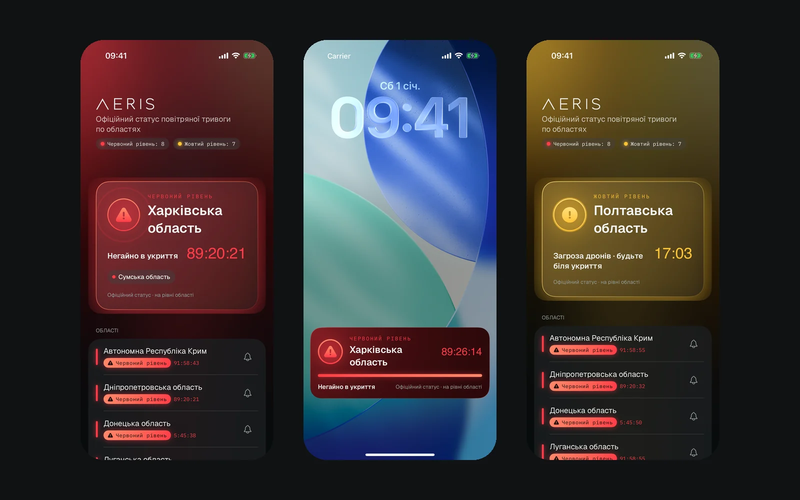
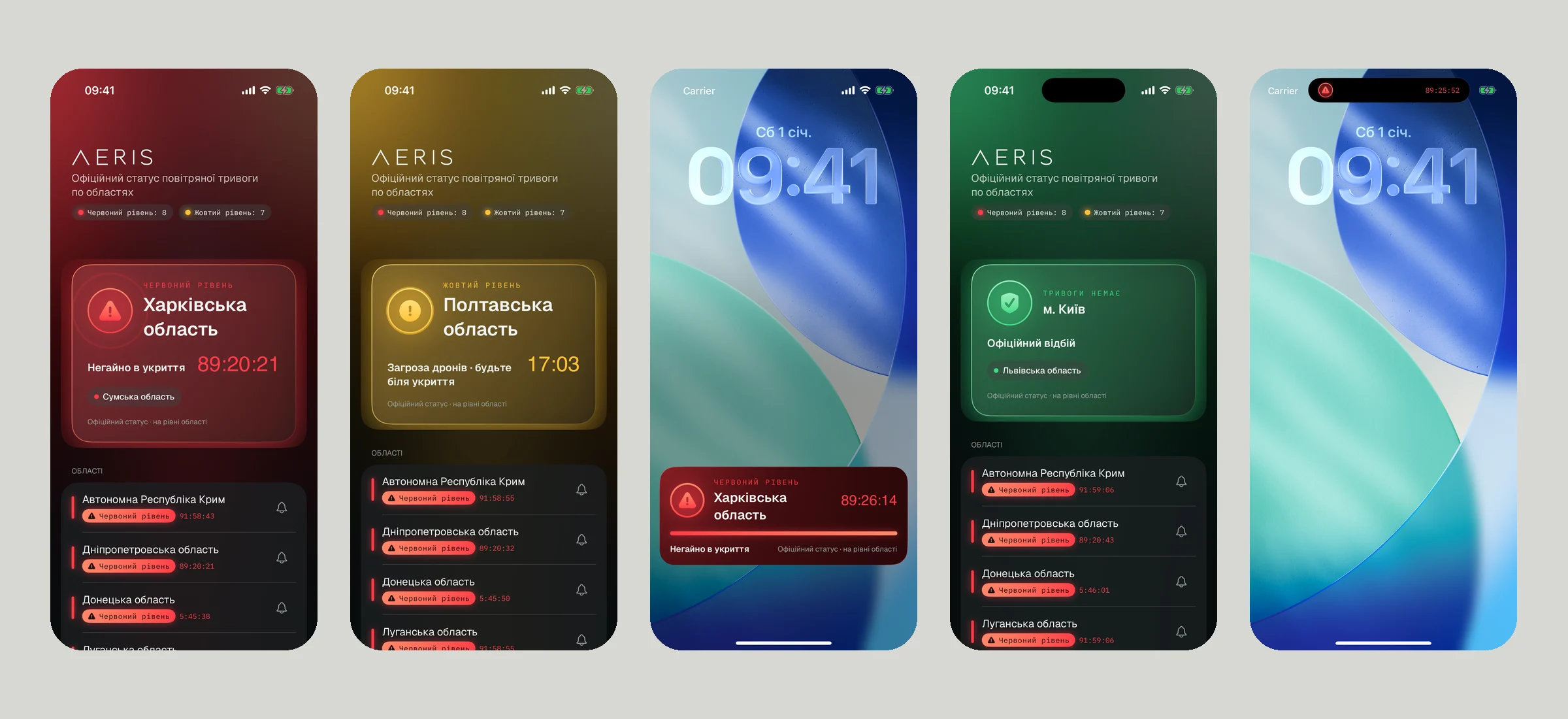
Map and list of oblasts, alert start/end notifications, a timer on the lock screen and in the Dynamic Island. No sign-up.
Making the invisible airspace visible.
A civilian early-warning system. It fuses official alerts and open sources into zone-level risk — with probability, confidence and an explanation.
Threat information is scattered across official alerts, Telegram channels and monitoring communities. Reports duplicate each other and nobody rates how reliable they are. People and businesses struggle to see what is happening now and what comes next.
Aeris gathers signals from many sources, removes duplicates and shows risk for every zone at 5, 15 and 30 minutes. Every assessment comes with a plain-language explanation: why the system thinks so and how confident it is.
Collect data: official alerts, open sources, weather and, later, partner sensors.
Normalise everything into one format and map it to zones, never exact coordinates.
Reports from one origin count once: 100 reposts don't raise confidence.
ML models score zone risk overall and for drones, missiles and glide bombs.
People see the result on the lock screen, in the Dynamic Island, in the Mac notch or in the Control Center.
Map and list of oblasts, alert start/end notifications, a timer on the lock screen and in the Dynamic Island. No sign-up.
Alert status next to the MacBook notch, with a sound when an alert starts.
An operator console: risk map, incidents, forecasts, anomalies, infrastructure, sources.
A region map at aeris-app.com/alerts.
REST and WebSocket for integrations, a public alerts endpoint.
Every assessment has probability, confidence, data quality and reasons.
The public app is free — it builds reach and trust. The paid side is the platform for organisations: Control Center, API and sensor integrations. Pricing for organisations is not set yet.
| Public app | Free | iOS, macOS, alerts board |
|---|---|---|
| Organisations | On request | Control Center, roles, multiple teams, forecasts, infrastructure |
| Integrations | On request | API, partner cameras and acoustic sensors |
Version 1.0 has been in production since 1 October 2026: public site, alerts board, API and Control Center. Official alert data has been flowing since 12 October. The iOS app is not yet submitted to the App Store; it will show the official alert status by oblast, while risk forecasts are a feature of the platform for organisations.
Ukraine has the world's most battle-tested public-warning audience: one alert app alone has 46M downloads and 6.7M daily users. Mass notification is forecast at ~$47B by 2030, and Everbridge's $1.8B buyout shows what a critical-event-management platform can be worth.
“Air Alert” (Ajax), alerts.in.ua, Kyiv Digital — show the official alert status. Everbridge, Genasys — enterprise and government notification. Aeris differs with multi-source fusion, 5–30 minute zone risk forecasts with explanations and a platform for organisations, not just a siren on the phone.
| Oct 2026 | Platform v1.0 in production, official alerts, Control Center | ■ Done |
|---|---|---|
| Next | iOS app in the App Store | □ |
| Next | Public macOS release and lock-screen widget | □ |
| Next | Partner data source integrations | □ |
| Next | Citizen sensor mode on the phone — opt-in, processed on device | □ |

Raising €400k for 18 months — investment, grants or a mix. The platform already runs in production; the money goes into releasing the apps, new data sources and the first paid pilots with organisations.
Pre-seed, SAFE · can be combined with grants
| EngineeringiOS and macOS, widgets, risk ML models | 40% | |
|---|---|---|
| Data & sensorsPartner sources, acoustic sensors, citizen sensor | 20% | |
| Pilots & salesControl Center for communities and infrastructure operators | 15% | |
| Security & auditExternal audit, attack resilience | 10% | |
| Contingency | 15% |
Next, a seed round to support contracts with government and infrastructure organisations in Ukraine and EU countries facing similar threats.
Want to know more about this product? We'll send metrics, the financial model and a demo.